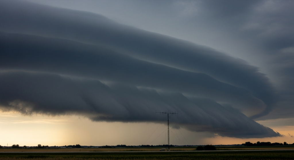
Severe weather is forecast to impact areas stretching from the northern Plains into parts of the Upper Midwest on Sunday, June 28, 2026. Independent weather-risk summaries have flagged a potential for severe thunderstorms across these regions. The primary hazards identified in these non-federal analyses are large hail and damaging winds. While a tornado risk exists, it is projected to be lower than the threats posed by hail and wind.
The forecast suggests that outdoor activities and travel plans in the affected areas may need to be adjusted. Residents and travelers are advised to monitor weather updates from official sources and to prepare for potential disruptions. The severity and exact location of the storms will become clearer as the day progresses.
This outlook is particularly relevant for individuals planning outdoor events or extended travel through the affected corridors. The potential for severe weather necessitates a cautious approach to any outdoor endeavors scheduled for Sunday. The specific timing and intensity of the storm systems will dictate the extent of their impact on daily routines and planned activities.
While the immediate focus is on the northern Plains and Upper Midwest, the broader implications of severe weather patterns can extend to regional travel and logistics. The presence of significant atmospheric instability indicates a dynamic weather situation that warrants close observation. The confluence of atmospheric conditions points to a heightened risk for severe thunderstorm development, characterized by the potential for large hail and strong, damaging winds.
The information available indicates that the tornado risk, though present, is secondary to the more probable threats of hail and wind. This suggests that the storm cells, should they develop into severe thunderstorms, are more likely to produce widespread wind damage and significant hail accumulation rather than widespread tornado activity. Nevertheless, the possibility of isolated tornadoes cannot be entirely discounted and remains a component of the overall severe weather threat.
This forecast underscores the importance of staying informed about evolving weather conditions. As the day unfolds, further details regarding the trajectory and intensity of these storm systems will become available. Preparedness is key when severe weather is anticipated, and understanding the primary threats allows for more targeted safety measures.
This weather outlook serves as a critical advisory for those in the path of the projected severe thunderstorms. The potential for significant hail and damaging winds requires attention from individuals, businesses, and local authorities in the affected regions. Planning for contingencies is a prudent measure when facing such meteorological conditions. The dynamic nature of severe weather means that forecasts can evolve, making continuous monitoring essential.
Why it matters in Florence:
While the primary severe weather threat is concentrated in the northern Plains and Upper Midwest, the broader atmospheric patterns can influence regional weather systems. For Florence, this means that while direct impacts from Sunday’s severe thunderstorms are unlikely, the underlying atmospheric instability that fuels such events can sometimes contribute to localized weather shifts. Travelers heading north or west from Florence should remain aware of the severe weather advisories in those regions. Furthermore, understanding the potential for widespread severe weather across the country highlights the interconnectedness of weather systems and the importance of national weather monitoring for comprehensive local planning, especially for events like the upcoming Fourth of July celebrations which may involve travel for many residents. The potential for significant hail and wind damage in other parts of the country can also impact supply chains and transportation routes that affect businesses in Florence, such as those relying on logistics from companies like Walmart Associates Inc. or Sonoco Products Company.