News Summary
A polar vortex is approaching the continental United States, bringing hazardous freezing conditions starting Saturday. Nearly 300 million Americans will experience dangerously low temperatures and severe wind chills, especially in the Midwest and East Coast. Snowfall is also expected in various regions, leading to potential hazardous conditions. Safety alerts for hypothermia and frostbite are urged, as temperatures may drop as low as minus 55 degrees wind chill. Inauguration Day events will be held indoors due to these extreme conditions, marking a notably cold week ahead.
A Polar Vortex is Headed Our Way
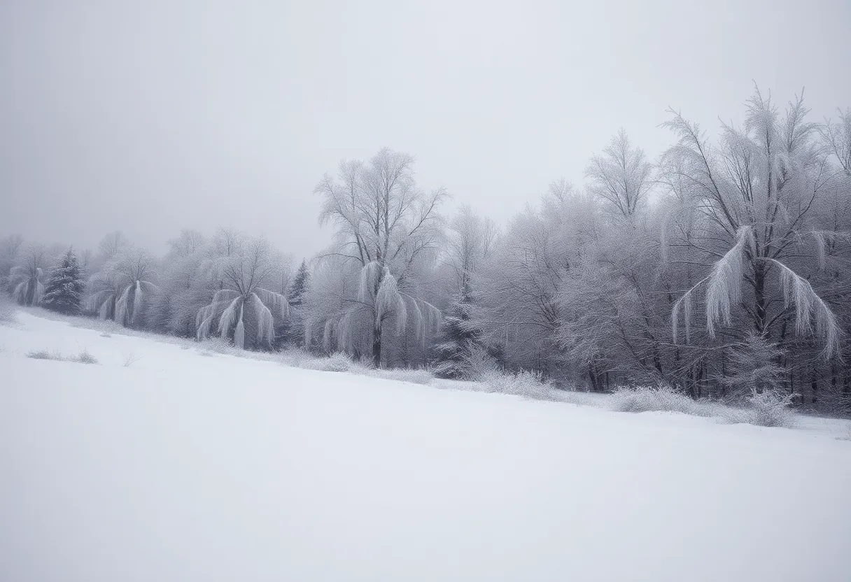
Get ready for a **wild weather twist**! A polar vortex is gearing up to sweep across most of the continental United States starting Saturday, bringing with it some seriously **hazardous freezing conditions**. This chilly arctic blast is set to impact nearly 300 million Americans, stretching from the cheery Deep South all the way to the crisp Northeast.
Brace Yourself for the Cold
The National Weather Service is raising alarms about **dangerously low temperatures** and bitter cold wind chills. The hardest-hit areas will be the Midwest and the East Coast, with expectations of frigid conditions making their way down from the Rockies and Great Plains. By Saturday night, you can expect those sub-zero temps to roll into the northern Plains and Upper Midwest, sinking as low as **negative digits**!
Safety First: Hypothermia Alerts
For many, this weather means serious risks. Hypothermia and frostbite are **real threats** with sub-freezing temps expected in parts of the Gulf Coast too. Keep an eye out, especially if you’re in the Rockies, Northern Plains, or Upper Midwest, as wind chills could plummet to **30-55 degrees below zero** starting Sunday!
Snow, Snow, and More Snow
If you thought the cold would be the only issue, think again! Snowfall is projected across the Appalachians, the Upper Ohio Valley, and into the Northeast region. Expect the heaviest **snow accumulation** of up to **8 inches** right north and west of the I-95 corridor. Areas like West Virginia and East Maine will likely see substantial drops of snow!
A Storm Cyclone Ahead
A storm cyclone may even kick off lake-effect snow across the upper Great Lakes before heading to Canada’s Maritimes by Monday. Meanwhile, down south, northern Florida and southern Georgia can anticipate rain showers and likely thunderstorms overnight Saturday.
Inauguration Day Adjustments
Due to these severe weather conditions, Donald Trump’s presidential inauguration will be held **indoors**. Those in the Northeast should be especially cautious as winter storm warnings are in effect for states including New York, Massachusetts, Connecticut, Pennsylvania, and New Jersey. New Jersey Governor Phil Murphy has already declared a **state of emergency** starting Sunday morning to handle the severe cold and impending storm.
Too Cold for Comfort
Just when you thought it couldn’t get any colder, forecasted temperatures this weekend are projected to be a whopping **20-25 degrees below average** for this time of year. For those headed to the NFL playoff games on Sunday, prepare for wind chills in the **negative 20s** across Northern Plains and single-digit feels in the Central Plains. Yikes!
Atlanta Might Even Freeze
In a surprising turn of events, Atlanta may chill out at the freezing point (32 degrees Fahrenheit) on Monday with wind chills dipping into the 20s! The forecast hints at **at least 19 record-cold high temperatures** across the Midwest and Plains. Mark your calendars, as Monday’s inauguration in Washington D.C. is anticipated to be the coldest in **40 years**—expect temperatures around **23 degrees** paired with those dreaded single-digit wind chills.
A Winter Wonderland or a Frigid Disaster?
The polar vortex is a massive area of cold air and low pressure that can swing down from the poles, creating extreme temperatures across the United States. It looks like this winter will be **colder than average** for many of us, so bundle up, stay warm, and take care as we brace ourselves for this icy blast!
Deeper Dive: News & Info About This Topic
- CBS News
- Wikipedia: Polar Vortex
- USA Today
- Google Search: Polar Vortex 2025
- Star Advertiser
- Google Scholar: Polar Vortex
- Washington Post
- Encyclopedia Britannica: Polar Vortex
- Axios
- Google News: Polar Vortex News