News Summary
The National Weather Service has issued a Severe Thunderstorm Warning for Darlington and Florence counties until 3:15 p.m. The warning highlights the potential for pea-sized hail and wind gusts up to 50 mph, with Doppler radar indicating strong thunderstorms moving through the area. Residents are advised to seek shelter indoors due to the risk of lightning and strong winds that could cause minor damage.
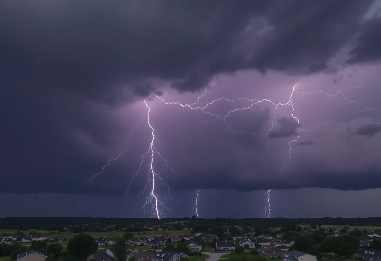
Darlington, SC — The National Weather Service (NWS) in Wilmington, North Carolina has issued a Severe Thunderstorm Warning for Darlington and Florence counties, effective until 3:15 p.m. on Friday. This alert highlights the potential for severe thunderstorms characterized by pea-sized hail measuring 0.25 inches and wind gusts reaching up to 50 miles per hour.
As of 2:33 p.m., Doppler radar identified a strong thunderstorm moving over Lydia, near Hartsville, advancing eastward at a speed of approximately 20 mph. The forecast suggests that gusty winds associated with this storm may down tree limbs and toss unsecured objects around, posing risks to outdoor safety. Minor damage to local vegetation from hail is also anticipated.
Areas directly impacted by the severe weather warning include:
- Hartsville
- Darlington
- Lamar
- Mont Clare
- Lydia
- Auburn
- Darlington Raceway
- Swift Creek
- Florence Darlington Technical College Main Campus
- Oats
- Floyd
- Kellytown
- Carolina Pines Regional Medical Center
Major highways affected include sections of:
- Interstate 20, between mile markers 126 and 141
- Interstate 95, near mile marker 146 and between mile markers 156 and 163
Residents and those outdoors are advised to seek shelter inside a building during the storm. The lightning risk is particularly high during thunderstorms, with approximately 25 million lightning strikes recorded annually in the U.S., leading to about 20 fatalities each year. The likelihood of a lightning strike increases as the storm approaches and remains high while it occurs, diminishing as the storm moves away.
Drivers should also exercise caution, particularly regarding hydroplaning, which can happen when water accumulates in front of a tire faster than a vehicle can move it, potentially causing loss of control.
The NWS has indicated that a severe thunderstorm watch is currently in place for the entire area until 10 p.m. this evening. Multiple rounds of showers and storms are predicted, with a heightened activity window anticipated between 3 p.m. and 6 p.m. for some counties. Rainfall totals could range from 0.5 inches to 1.5 inches, with minor wind gust threats primarily affecting inland areas. Although the threat of a tornado is low, it remains a possibility.
In preparation for the impending severe weather, the NWS encourages residents to stay informed and regularly check for updates. Safety tips during thunderstorms emphasize the importance of seeking indoor shelter whenever possible.
As this severe thunderstorm warning unfolds, authorities continue to monitor the situation, and further updates are expected as necessary.
Deeper Dive: News & Info About This Topic
HERE Resources
Severe Thunderstorm Alert Issued for Darlington and Florence Counties
Tropical Storm Chantal Hits the Southeast U.S. Coast
Severe Storms and Tornadoes Cause Tragedy in North Dakota and Minnesota
Severe Weather and Heat Wave Impact U.S. Communities
Major Heat Wave Set to Impact 255 Million Americans
Severe Thunderstorm Warning for Florence and Marion Counties
Severe Weather Prompts Governor’s Emergency Measures Across Texas
Flood Advisory in Florence County Expires
Severe Storms Cause Significant Tornado Damage in Central Wisconsin
Southeast Faces Major Flooding Threat as Atmospheric River Hits
Additional Resources
- Herald Online
- Wikipedia: Severe Thunderstorm
- The State
- Google Search: Severe thunderstorm watch
- Myrtle Beach Online
- Google Scholar: Severe weather alerts
- WPDE Weather Authority
- Encyclopedia Britannica: Thunderstorm
- ABC News 4
- Google News: Severe weather warnings