News Summary
A severe thunderstorm warning is in effect for Florence and Marion counties due to an approaching storm with wind gusts up to 40 mph. Areas like Lake City and Pamplico are advised to seek shelter as torrential rainfall and potential flooding are expected. Residents are urged to avoid flooded roadways and monitor weather updates. Safety measures are critical during this severe weather event as the risk of lightning and hydroplaning increases.
Florence, SC – A severe thunderstorm warning has been issued for Florence and Marion counties, effective until 2:45 p.m. on Friday, June 13, 2025. The warning was announced by the National Weather Service (NWS) Wilmington, NC, at 2:16 p.m. Residents should brace for wind gusts reaching up to 40 mph as a strong thunderstorm, tracked by Doppler radar, approaches the region.
The storm is currently located near Hannah, close to Lake City, and is moving north at a speed of 25 mph. Areas affected by this weather alert include Lake City, Pamplico, Hyman, Effingham, Hannah, Friendfield, New Hope, Evergreen, Scranton, and Coward. The NWS has advised residents in these areas to seek shelter indoors to protect themselves from torrential rainfall and the potential risk of localized flooding.
Residents are also advised against driving through flooded roadways, as this poses a significant danger. The severe thunderstorm is expected to produce gusty winds that can knock down tree limbs and send unsecured objects flying. The NWS emphasizes the importance of heeding the warning and taking appropriate safety measures during this severe weather event.
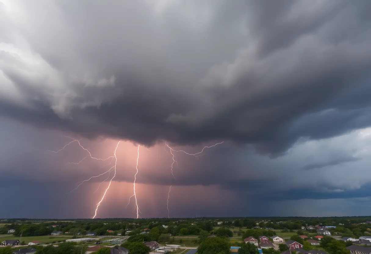
Severe thunderstorms pose considerable risks not only from high winds but also from lightning. The NWS reports that there are around 25 million lightning strikes across the United States annually, with most occurring during the summer months. Each year, approximately 20 fatalities result from lightning strikes, underscoring the danger of being outdoors during a thunderstorm.
As the storm approaches, the probability of lightning strikes increases, peaking when the storm is directly overhead and decreasing afterward. Safety tips include finding indoor shelter where possible, as staying indoors significantly reduces the risk of injury from lightning and flying debris.
Another hazard associated with severe storms is hydroplaning, which occurs when water pressure builds up in front of tires, causing a vehicle to slide uncontrollably on wet roads. The NWS has warned that both the rain and wind from the storm can lead to conditions favorable for hydroplaning. Drivers are encouraged to avoid situations that increase hydroplaning risks by being cautious of excessive water on roadways.
This severe thunderstorm warning highlights the need for residents to remain vigilant and prepared. To stay safe, it is crucial to monitor weather updates and have an emergency plan in place. The NWS continuously evaluates storm conditions and will provide further updates as necessary.
In conclusion, Florence and Marion counties are under a severe thunderstorm warning until 2:45 p.m. today. Residents in the affected areas should seek shelter, avoid flooded areas, and stay informed on weather developments as the storm progresses through the region.
Deeper Dive: News & Info About This Topic
HERE Resources
Severe Weather Prompts Governor’s Emergency Measures Across Texas
Flood Advisory in Florence County Expires
Severe Storms Cause Significant Tornado Damage in Central Wisconsin
Southeast Faces Major Flooding Threat as Atmospheric River Hits
Weather Challenges Anticipated in Myrtle Beach This Weekend
Severe Thunderstorm Warnings Issued for Wilmington Area
Severe Thunderstorms Cause Damage in Dillon County
Myrtle Beach Weather Update: Warm and Humid Conditions Before Possible Freezing Rain This Weekend
Horry County Schools Earn Prestigious Palmetto’s Finest Award
Severe Thunderstorm Warnings Hit Georgetown County
Additional Resources
- Island Packet: Severe Thunderstorm Warning
- Wikipedia: Thunderstorm
- Herald Online: Weather News
- Google Search: Severe Thunderstorm Warning
- WPDE: Severe Thunderstorm Watch
- Google Scholar: Severe Thunderstorm Impacts
- Times Daily: Colbert County Weather Alert
- Encyclopedia Britannica: Thunderstorm
- WAAY: Power Outage in Florence
- Google News: Florence SC Weather